Saturday, June 27, 2009

Where the Time Changed its Course


This is Dhauli Giri on the Banks of River Daya, where the bloodshed of Kalinga War took place some 1000 years ago. Here time changed its course, when Emperor Asoka underwent a spiritual transformation. This bank was destined to steer the Time to a different direction. This is one of the few Buddhist site present in Bhubaneswar. This famous Shanti Stupa is a world famous Buddhist Monument.

The Older Beauties Again


At the other end of the city, lies the glories of the past.The City has preserved the evidences of its rich History. Magnificent architecture in the Old Town attracts millions of tourists every year. This part of the city has won the sobriquet of "Garland of Temples" for Bhubaneswar. Rich historical past & the Modern Developments at the other end is a perfect blend of the Past, Present & Future glimpses of Time.

Hotel May Fair Lagoon


This Hotel is very near to the same Highway and is the favorite one for Foreign Tourists, Indian Cricket Team & all Young People.

A view from Jaydev Vihar flyover


This road is taking Bhubaneswar to a new direction of growth. Bhubaneswar is not the same anymore. The city is crossing horizons with this highway.

Thursday, June 25, 2009


Cool Hang out complex facing Fortune tower and XIMB

East Coast Rly. Head Quarters.


This newly built building on the same highway is the largest Rly. Building in the country.

Star Hotels on the Highway


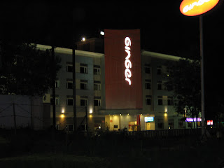
Hotel Ginger, Trident & Swosti Plaza.

Fortune Tower


In the state, Fortune Tower is home to many Big corporate houses.

Road to the Future


This, Highway from Jaydev Vihar to CSpur will be the Busiest Highway of the city in the years to come. Beautiful steel railings add to the Corporate get up of this Highway.
This highway boasts the presence of Fortune Tower, East Coast Rly. Office, NALCO, XIMB, Hotels like May Fair Lagoon, Ginger, Swosti Plaza, Trident, Pal Heights etc.

The Blushing Roads


The Naveen Pattnaik Govt. has made huge investment in Roadways. Now, going for a drive is a pleasant experience.

Bus Stop: Modern Public Amenities


Now, people don't mind waiting for their Buses.
Well maintained Public amenities: The Sign of a growing city.

Railway Station


The Beautiful Stone work of Kedargouri Temple

Kedargouri Temple

My Bhubaneswar

Lingaraj Temple

Bhubaneswar

From Wikipedia, the free encyclopedia

Jump to: navigation, search
Bhubaneswar
Temple City of India

Lingaraj Temple, Bhubaneswar
Map of India showing location of Orissa
Location of Bhubaneswar
Bhubaneswar
Location of Bhubaneswar
in Orissa and India
Country Flag of India.svg India
State Orissa
District(s) Khurda


Population
Density
647,302 (2001)
4,900 /km2 (12,691 /sq mi)
Time zone IST (UTC+5:30)
Area
Elevation
1,035 km2 (400 sq mi)
33 m (108 ft)

Coordinates: 20°16′N 85°50′E / 20.27°N 85.84°E / 20.27; 85.84

Bhubaneswar Bhubaneshwar.ogg pronunciation (Oriya: ଭୁବେନଶ୍ବର) is the capital and largest city of the Indian state of Orissa, India. Once the capital of ancient Kalinga, the city has a long history of 3000 years and is today a center for commerce and religious activity.From the ancient period Bhubaneswar was known in different names such as Toshali,Kalinga Nagari,Nagar Kalinga,Ekamra Kanan,Ekamra Khetra,Mandira Malinya Nagari or Temple city of India,Cathedral City of India etc.However, the modern city of Bhubaneswar was designed by the German architect Otto Königsberger in 1946. It became the modern capital of the state of Orissa in 1948, a year after India gained its independence from Britain. Before Bhubaneswar, Cuttack was the capital of Orissa until 1947. Both Bhubaneswar and Cuttack are known as the "twin cities" of Orissa. With its vast variety of Hindu temples, Bhubaneswar is often referred to as a Temple City of India.