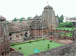
Bhubaneswar
From Wikipedia, the free encyclopedia
| Bhubaneswar | |
| Temple City of India | |
| | |
| | |
| Country | |
| State | Orissa |
| District(s) | Khurda |
| Population • Density | 647,302 (2001[update]) • 4,900 /km2 (12,691 /sq mi) |
| Time zone | IST (UTC+5:30) |
| Area • Elevation | 1,035 km2 (400 sq mi) • 33 m (108 ft) |
Coordinates: 20°16′N 85°50′E / 20.27°N 85.84°E
Bhubaneswar ![]() pronunciation (help·info) (Oriya: ଭୁବେନଶ୍ବର) is the capital and largest city of the Indian state of Orissa, India. Once the capital of ancient Kalinga, the city has a long history of 3000 years and is today a center for commerce and religious activity.From the ancient period Bhubaneswar was known in different names such as Toshali,Kalinga Nagari,Nagar Kalinga,Ekamra Kanan,Ekamra Khetra,Mandira Malinya Nagari or Temple city of India,Cathedral City of India etc.However, the modern city of Bhubaneswar was designed by the German architect Otto Königsberger in 1946. It became the modern capital of the state of Orissa in 1948, a year after India gained its independence from Britain. Before Bhubaneswar, Cuttack was the capital of Orissa until 1947. Both Bhubaneswar and Cuttack are known as the "twin cities" of Orissa. With its vast variety of Hindu temples, Bhubaneswar is often referred to as a Temple City of India.
pronunciation (help·info) (Oriya: ଭୁବେନଶ୍ବର) is the capital and largest city of the Indian state of Orissa, India. Once the capital of ancient Kalinga, the city has a long history of 3000 years and is today a center for commerce and religious activity.From the ancient period Bhubaneswar was known in different names such as Toshali,Kalinga Nagari,Nagar Kalinga,Ekamra Kanan,Ekamra Khetra,Mandira Malinya Nagari or Temple city of India,Cathedral City of India etc.However, the modern city of Bhubaneswar was designed by the German architect Otto Königsberger in 1946. It became the modern capital of the state of Orissa in 1948, a year after India gained its independence from Britain. Before Bhubaneswar, Cuttack was the capital of Orissa until 1947. Both Bhubaneswar and Cuttack are known as the "twin cities" of Orissa. With its vast variety of Hindu temples, Bhubaneswar is often referred to as a Temple City of India.


